Day Hiking Hidden Lakes and Sahale Arm
First posted: 2022-10-25
2022 Sept 8 - 2022 Sept 9
Day 1 - Hidden Lakes
9.1 Miles
3295 Feet Elevation Gain
Camp at Mineral Park Campground on Cascades Pass Road
Day 2 - Sahale Arm
14.76 Miles
4762 Feet Elevation Gain
Hidden Lakes
After the trip to Flett Glacier, I realized the smoke was closing in on the season. I had to shift somewhere, so I shifted north. I also knew that once I graduated from UW, I will likely move back to Portland to save on rent money. So I should take advantage of my current location to hike as much the regions north of Seattle as possible.
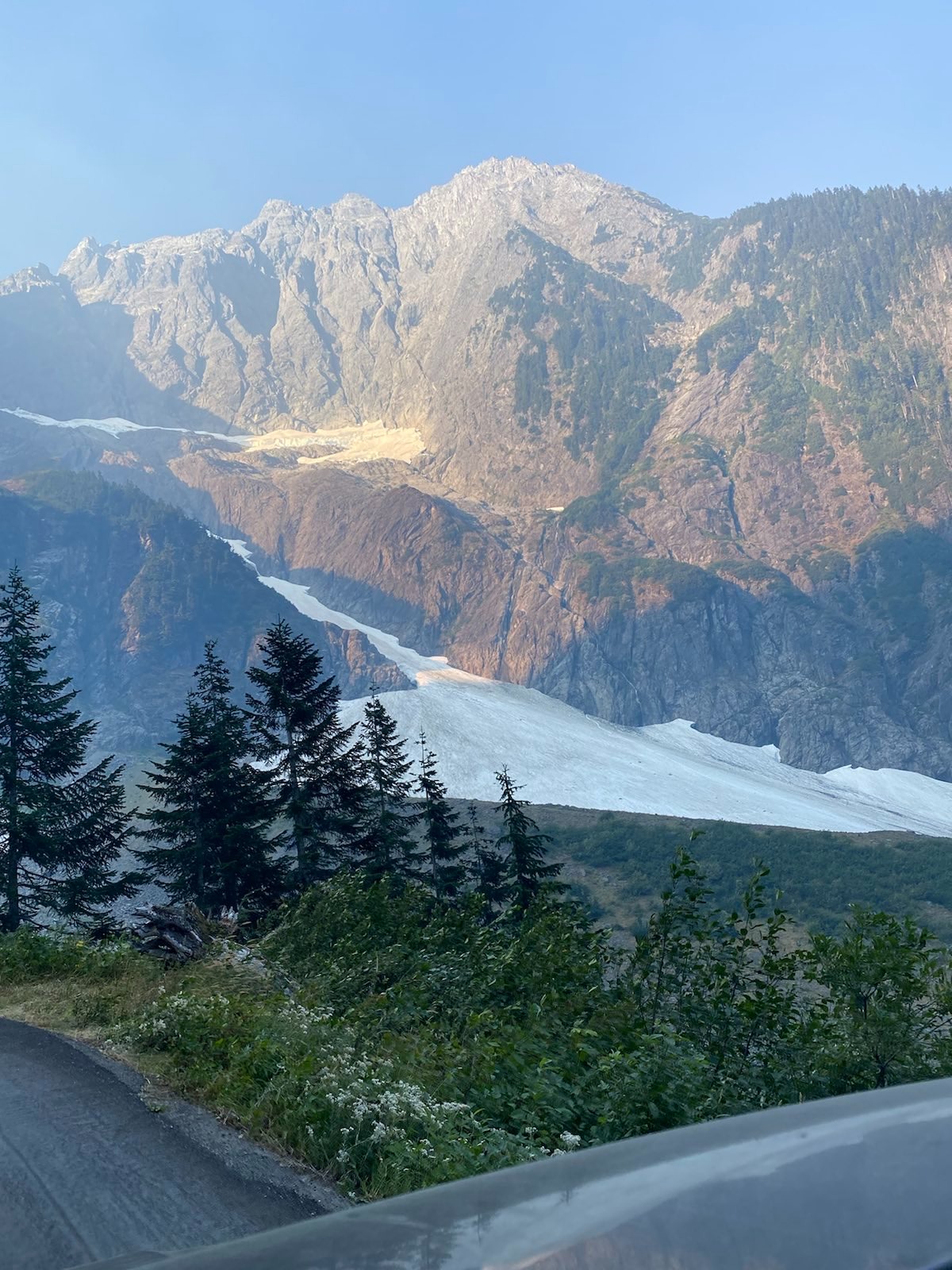
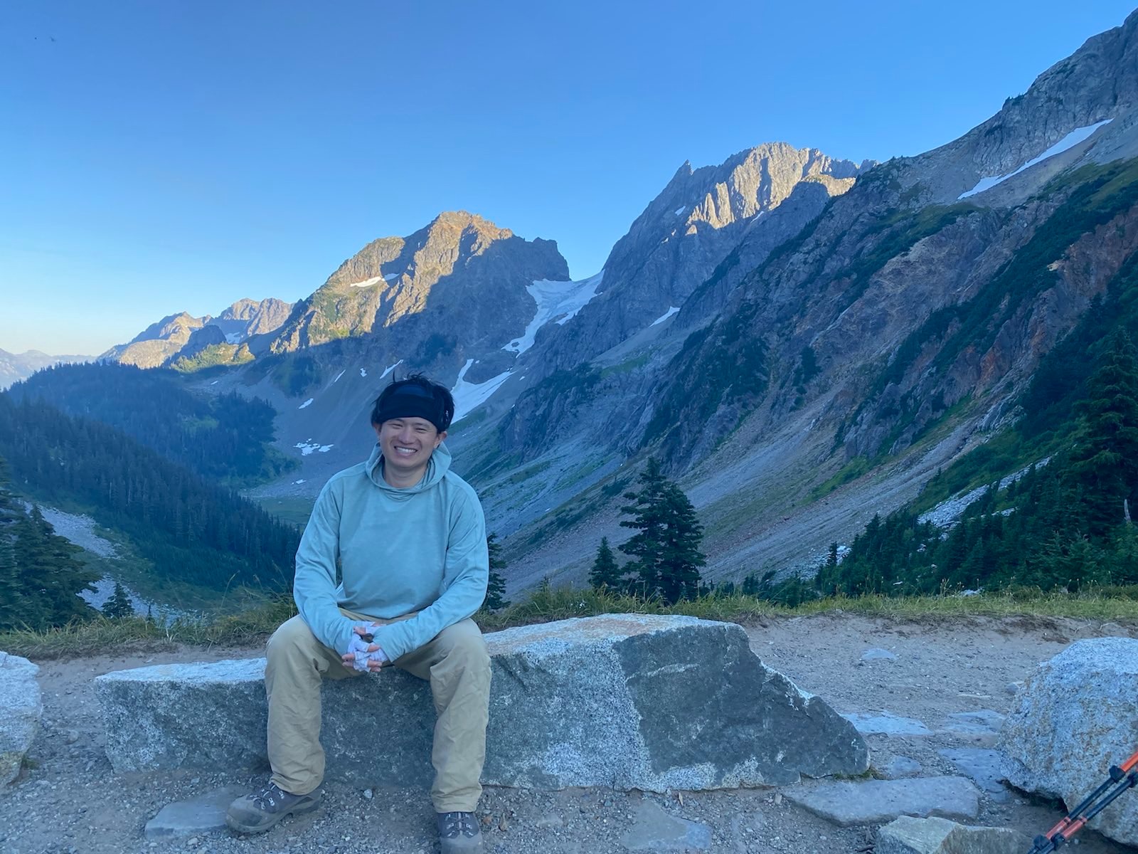
I had not yet been to North Cascades, so I thought this would be a fine introduction. (On the way up the dirt road to the trailhead, I saw this guy who was backpacking along the winding road. Why?) I arrived at Hidden Lake trailhead at 10am, which was already late. I snagged the last of 18 spots of parking. It was tight. (But actually, arriving this late also had a hidden benefit.) The trail to the lookout is actually quite short, and generally quite gentle, defined, and not dangerous. The smoke was quite bad down in the valley, and ascending didn’t make it any better.
Going up:
There were a lot of people. In fact, many of them coming down. It appears most people arrived very early, and either reached the top and got turned off by the smoke, so left early, or just backed out halfway due to the smoke. But I knew there was wind due this afternoon, and at least for three days straight, so I was betting on that. I kept going. Eventually, I could see the lookout teetering over what looked like an impossibly tall spire. I had to get up that? But I did.
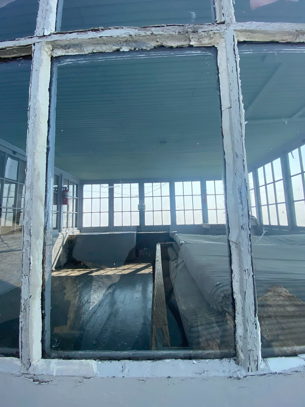
Inside the lookout:
View from mountaintop:
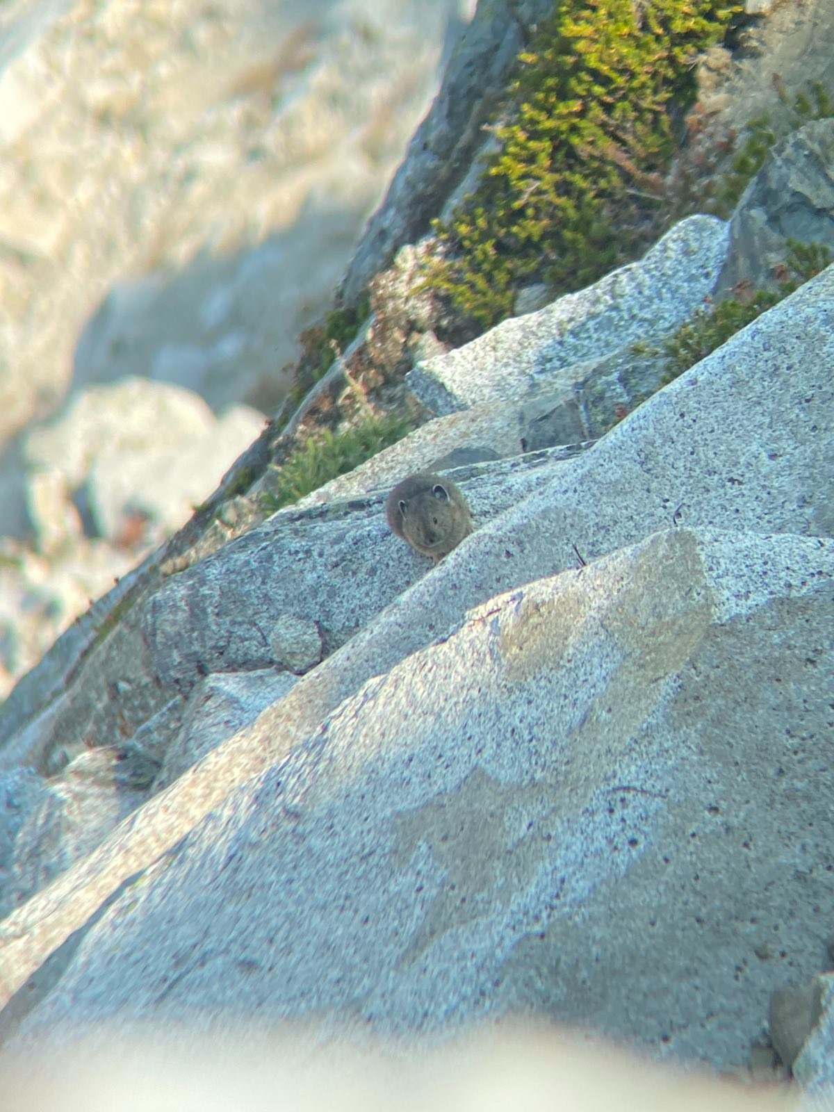
As I sat on the mountain side, waiting for the winds to come, I saw a little pyka. It kept looking at me. Menacingly.
At this point, I got signal, and I recieved an interesting message. Queen Elizabeth II had died. What a strange message to receive while I was on the top of this smoky mountain. Though I try to escape real life, real life always comes back to me. Only on really long deep backpacking trips would I be able to escape real life, and even then, the rhythm of taking photos with my phone would be a reminder of the speed of real life. I would soon buy a film camera to slow myself down, even if it was a bougie thing to do.
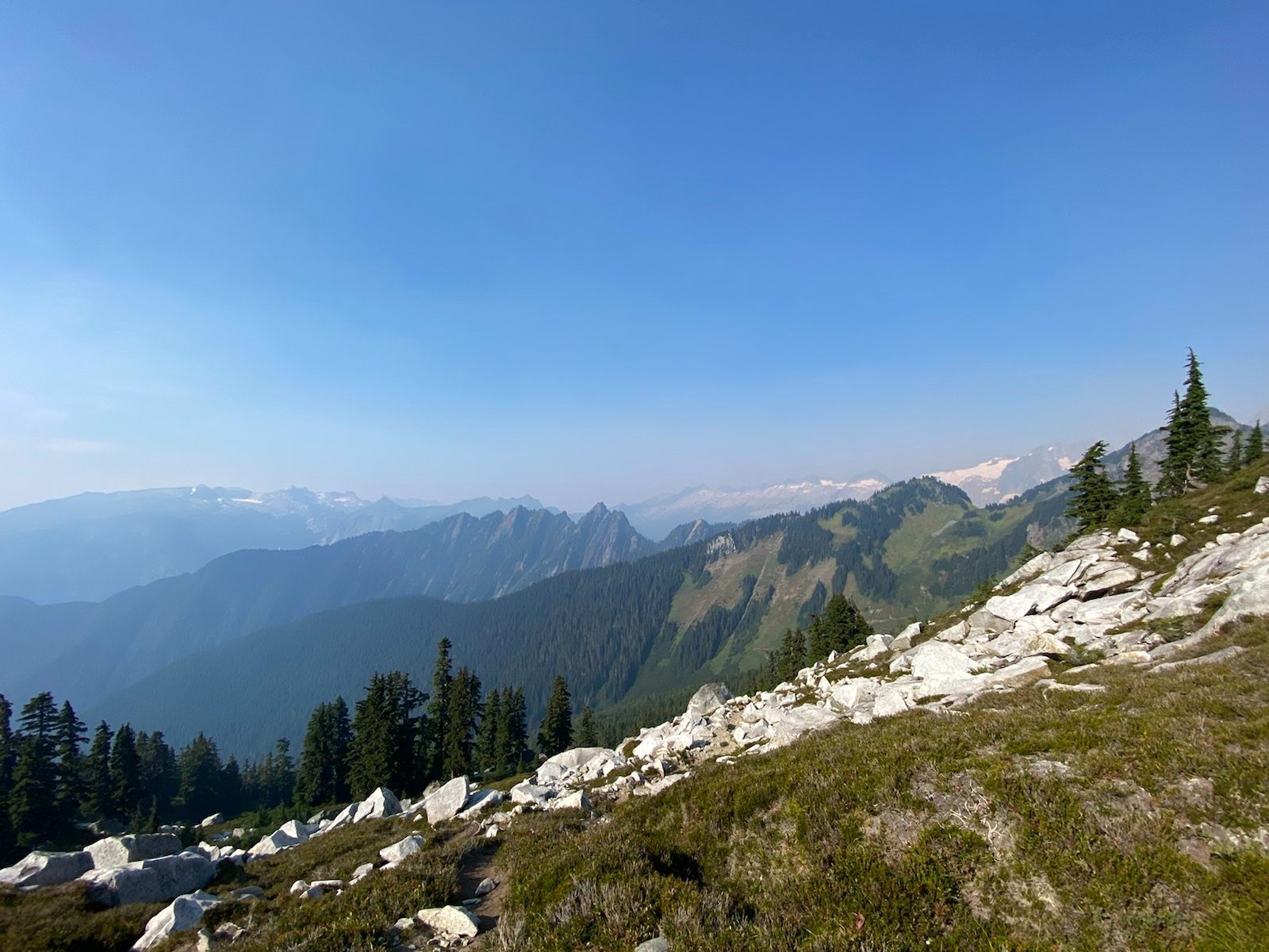
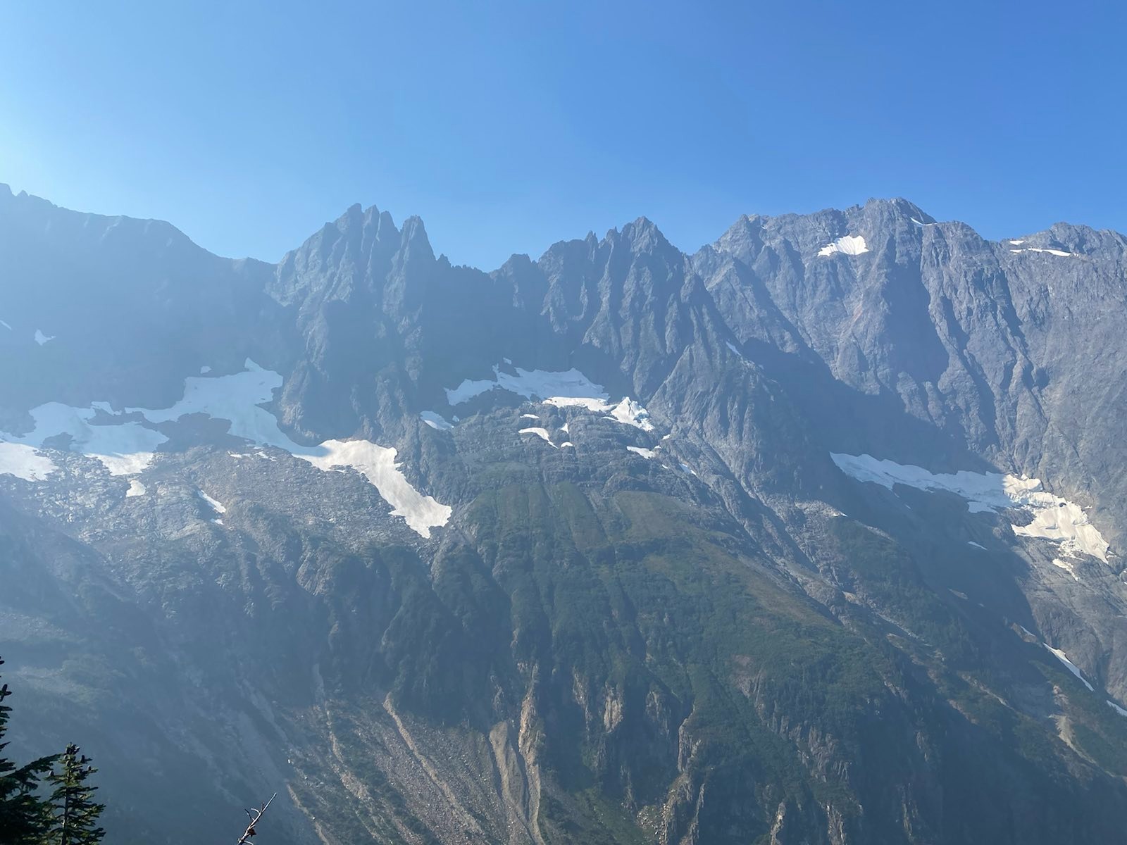
Finally the winds cleared to the extent that I could make out El Dorado Peak and Glacier in the back. It was faint, but visible. A little bit dissappointing, and I wondered what it would have looked like without all the smoke. At this point around 4pm, I was the only one up here. The winds, despite blowing hard and trying their best, could not push away the smoke. I was getting cold. I decided I should start going down, since it was clear that the smoke was too heavy today. As I was going down, I met the backpacker who was walking on the road. He said he came all the way from Darrington, because last time he parked along the Cascade Pass Road his car was totally vandalized, burgalrized, and wrecked. He said never again. So he hiked the entire road and up to this lookout. I’m not sure if he was insane, traumatized, or just hardcore. He seemed very sketchy, so I decided to yeet out. In total, I spent from 1pm to 4pm up next to the lookout.
On the way down, the western glaciers on El Dorado started appearing, and the view was good. I could finally see the far ridges and hills along the valley I came up. It was nice.
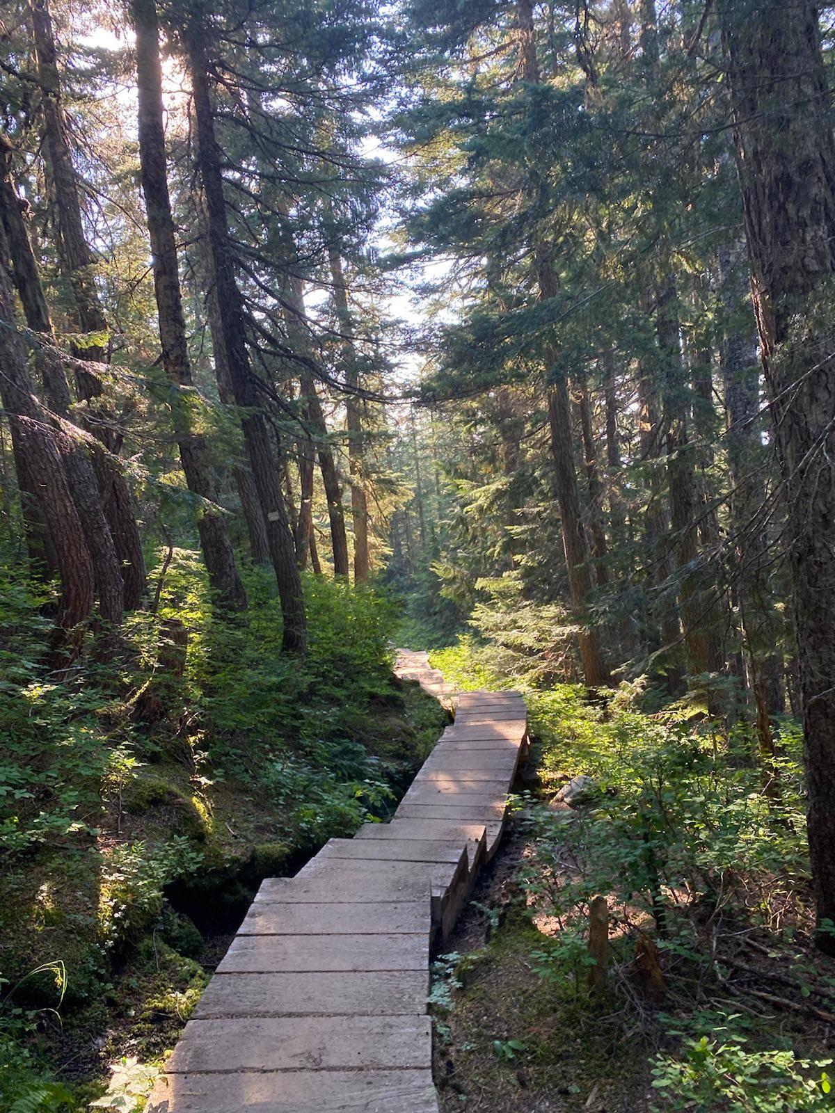
Going back into the forest, the air was cleaner, and the trail had some nice walkways and stairs. Not having to walk on the degraded mud trail (due to heavy use) was a creature comfort.
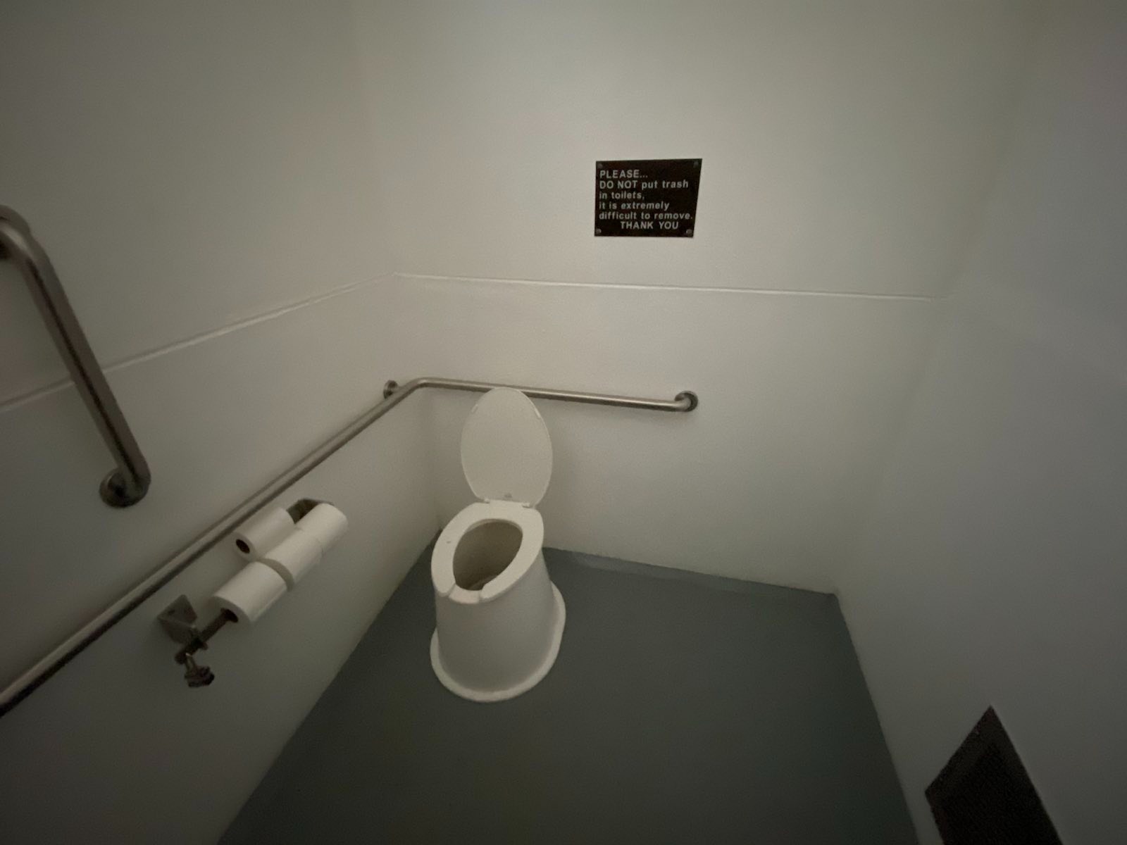
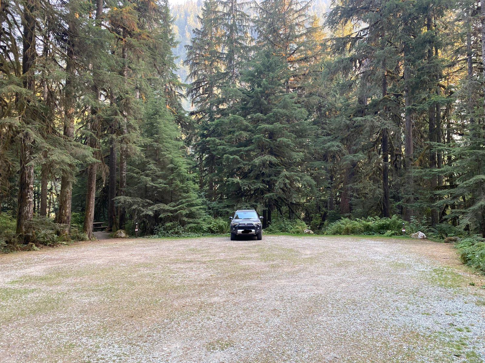
Arriving at the car, I drove a half hour deeper into the Cascades, and arrived at Mineral Park Campground (East Section). There are four spots there, and I was the only one that night, despite each spot being reserved. I wonder if there should be a better way, people deserve to camp here, but at the same time, reservations are important. Perhaps there should be a rule that if a spot isn’t taken by 9pm, it is now open to anyone. In any case, the quiet was nice. All to myself, this giant campground. And the pit toilet was the cleanest I have ever been to. It was incredible. Thank you, person who manages Mineral Park!
Super clean toilet, literally no bugs, and nice fragrent smell:
At night I considered what I should do the next day. The smoke was heavy, and the winds didn’t blow it away today. But Sahale arm would be much higher, and much deeper into the mountains, so maybe the smoke was less thick? I didn’t know what to do. I fell asleep. The next morning I just knew I had to go. I drove 3.5 hours out here already, and I camped here… So Sahale Arm had to be done!
All alone:
Day 2
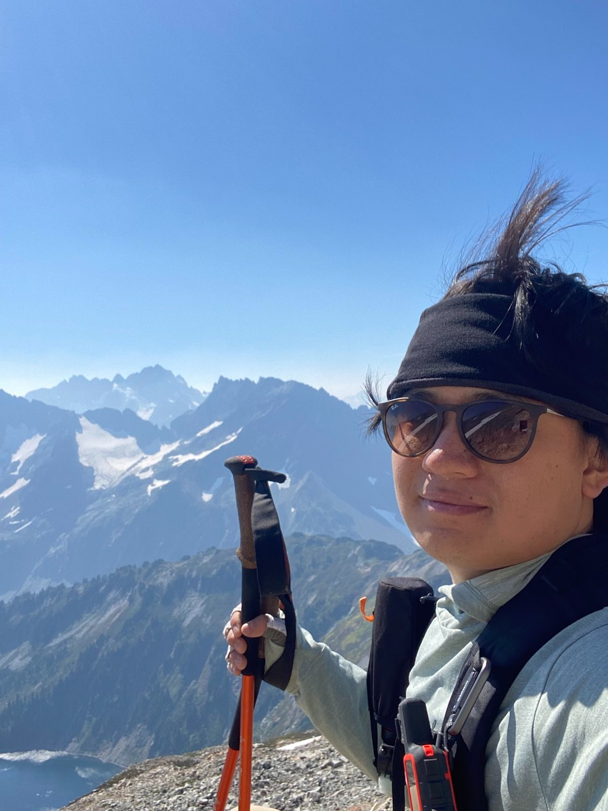
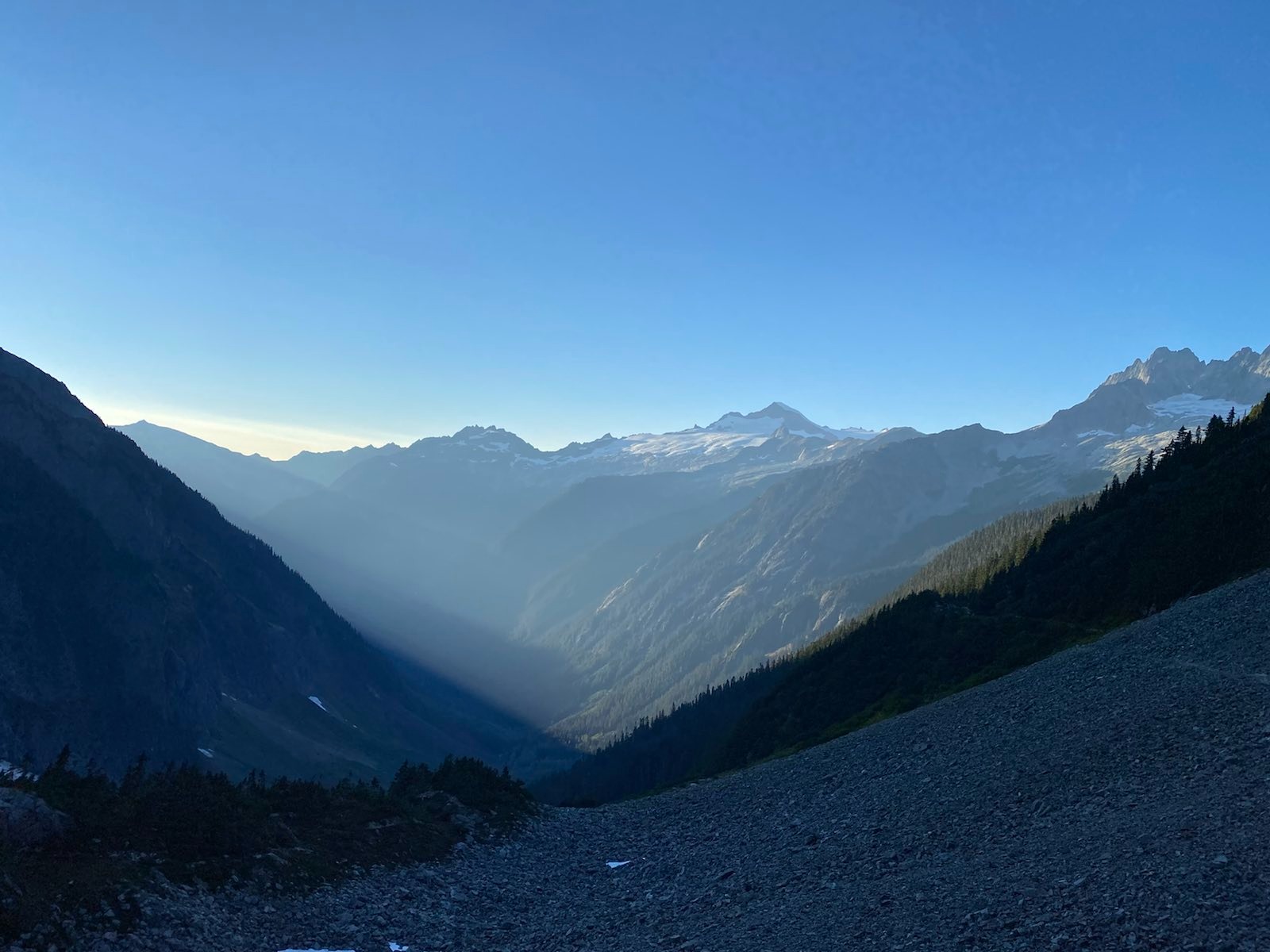
I arrived at the famous Sahale Arm Trailhead at 9am. The parking lot was half full. The wind was very strong, even below the pass. Some of the people who arrived with me seemed visibly hesitant to go up. But I had to go up.
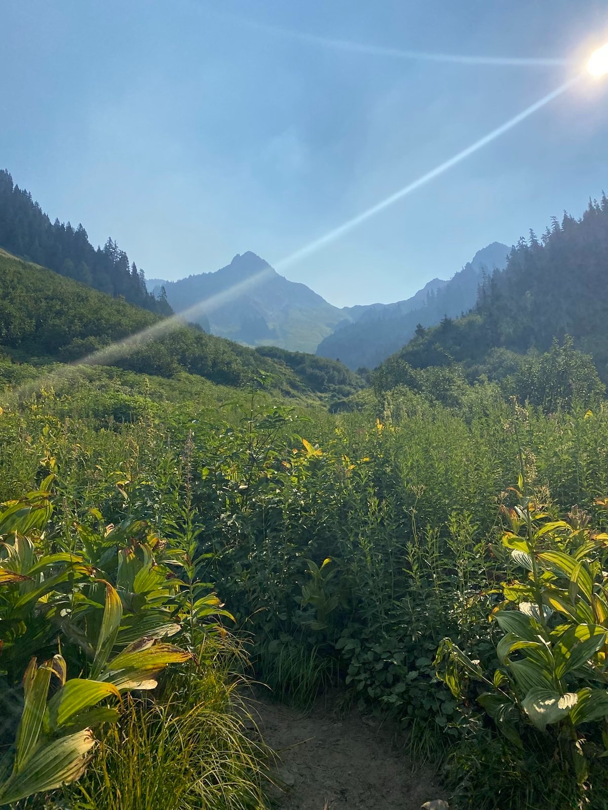
The scale of the valley before the pass is awesome.
Going up the pass is long, the switchbacks take close to two hours, but the grade is safe and gentle. I keep yelling to scare off bears, as there was a report two weeks ago that Bear #380 was killed by Rangers because it kept maurading peoples’ food. This meant that people here were not careful about their food. Which meant that a lot of bears were probably mauarding around. I kept yelling, despite nasty looks from this old couple. Screw them. On the other hand, a younger couple who zoomed past me thanked me for clearing the way. Most people simply don’t yell. They just don’t think an attack will ever happen. They have no sense of bear safety, no understanding of bears. Such lack of knowledge and careless actions make it more dangerous for all hikers and wildlife. People really need to be educated, or they shouldn’t be allowed on these fragile lands. The amount of cut switchbacks along the initial climb was also very sad. Many turning sections were eroded out. Some trees looked like they were about to fall.
Up switchbacks, view:
Cresting Cascade Pass, looking back towards Hidden Lakes Lookout:
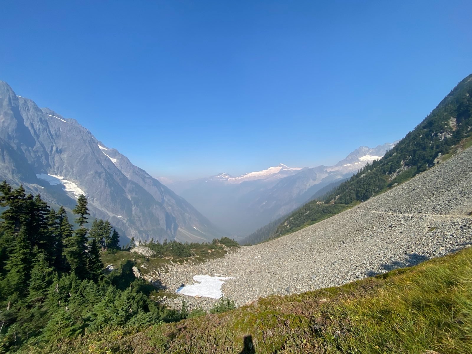
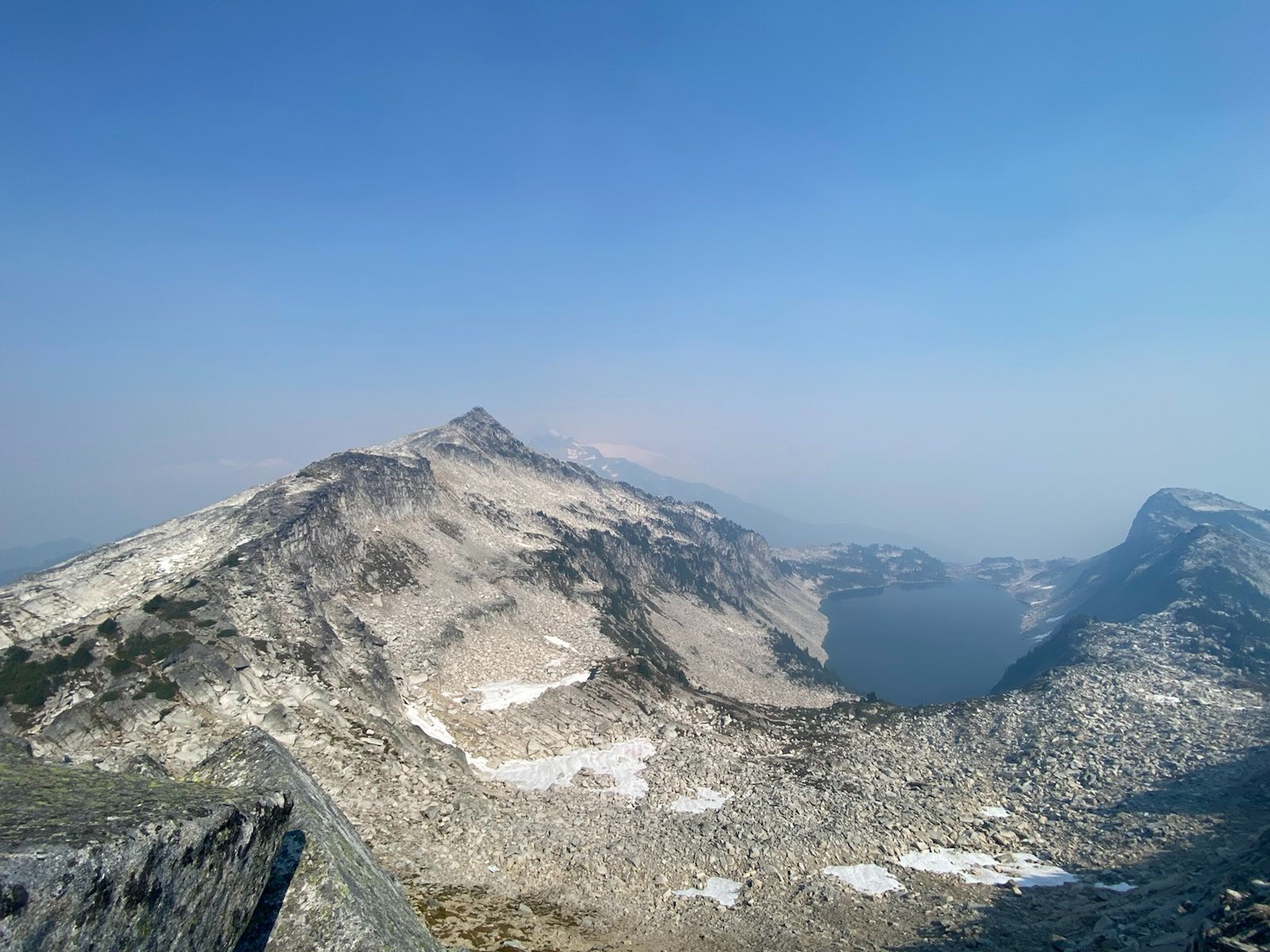
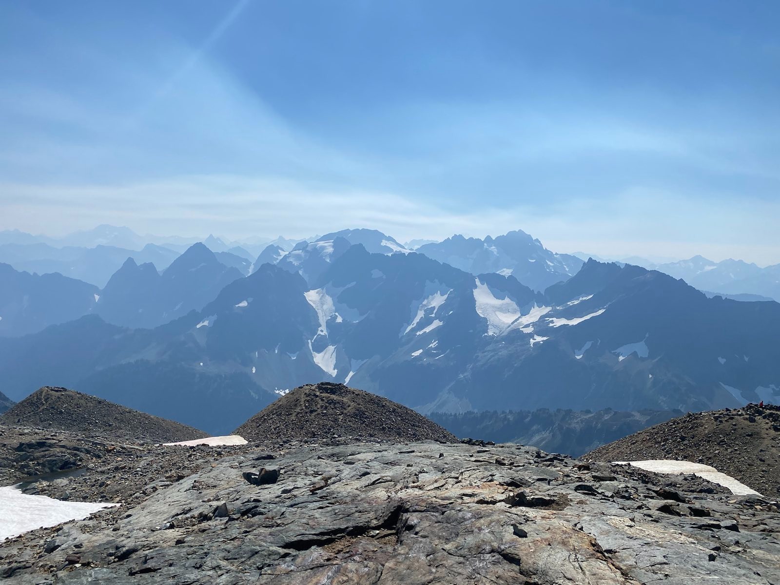
The wind at the pass was insane. It had cleared out most of the smoke in the lower valley, but in the upper valley the smoke had not cleared. I was bummed, but I hoped it would clear soon. Looking back at Hidden Lakes Lookout direction, I could see Hidden Lakes Mt and El Dorado Through my 12*45 Zeiss, I could barely make out the lookout and the lake. It was time to keep going up.
After cresting the second hill, I was at the first viewpoint.
It was incredible. I thought, this would be a great place to just sit for a while. But it was too early, and the trail kept going. So I pressed on. As I neared the arm proper, it got windier and windier, and it got steeper and steeper. Despite exerting very hard to go up the rocky landscape, I still was compelled to put on my second shirt, so windy it was. Many people turned around at this point due to the wind.
Across the previous photo:
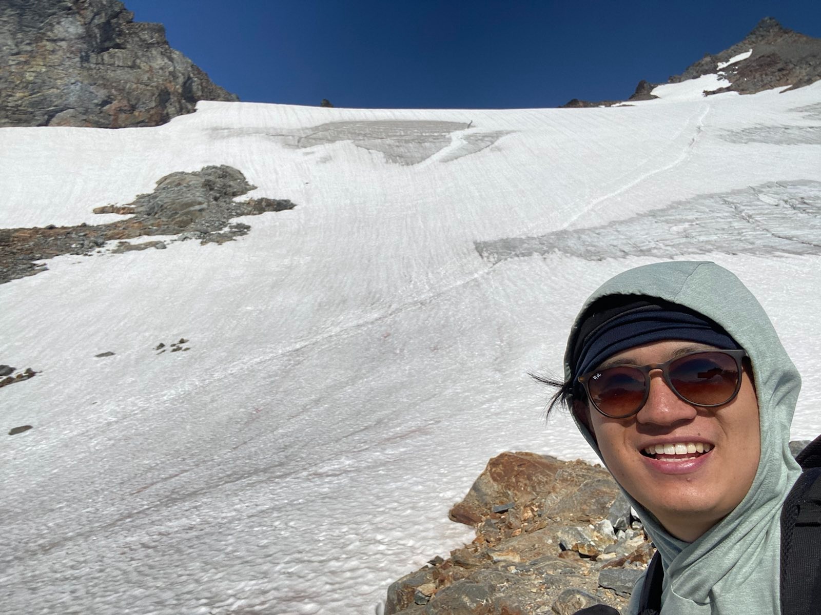
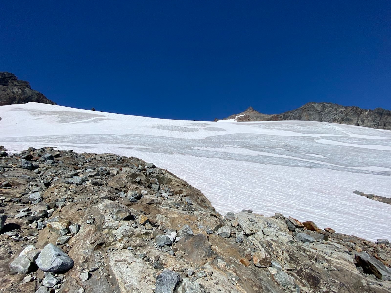
The final climb up to the Sahale Plateau was very windy and kind of sketchy. There was a twenty minute section with a semi steep and very long drop on scree/rock, and the steepness kept making the scree loose. At one point, I really thought about quitting, because it was getting super steep and sketchy. But I was so close. Finally, I made it to the plateau. I suddenly realized, that the smoke in the vicinity was mostly cleared away! Although in the far distance the smoke was still there, the nearby areas were mostly clear. Vision was not the best, but much better than yesterday.
Sahale Glacier, view from Plateau:
I was surprised by how many people were at the plateau. In fact, it seemed like there were at least 12 other day hikers, and 4 overnighters who were packing up to leave. I made my way up to one of the sky castles, as I call them, where rings of rocks protect flat campsites from the inevitable wind. Up at the sky castle, I met a camper who was packing up to leave. I asked her how the night was, and she said it was cold, but she didn’t feel it because she was too tired from going up the glacier and up to the peak yesterday. I looked at her equipment. You did that alone? Without rope? Or spikes? Or an axe? Or helmet? She replied, yea it probably wasn’t the smartest idea but I made it all the way yup. I pointed at the huge crevasse: that didn’t scare you? Eh, well, you know, if you stay far away you have leeway. I just stared at her in disbelief. I then asked her about the famous Sahale toilet, and she said it was totally full. She had brought a wag bag instead. I thanked her for her story, and I continued my way across the plateau.
A sky castle campsite, one of many. This one was deeper along the plateau, most of the campers stayed close to the end of the main trail, where all the day hikers stopped. (Note the mountain goats on the mini glacier.)
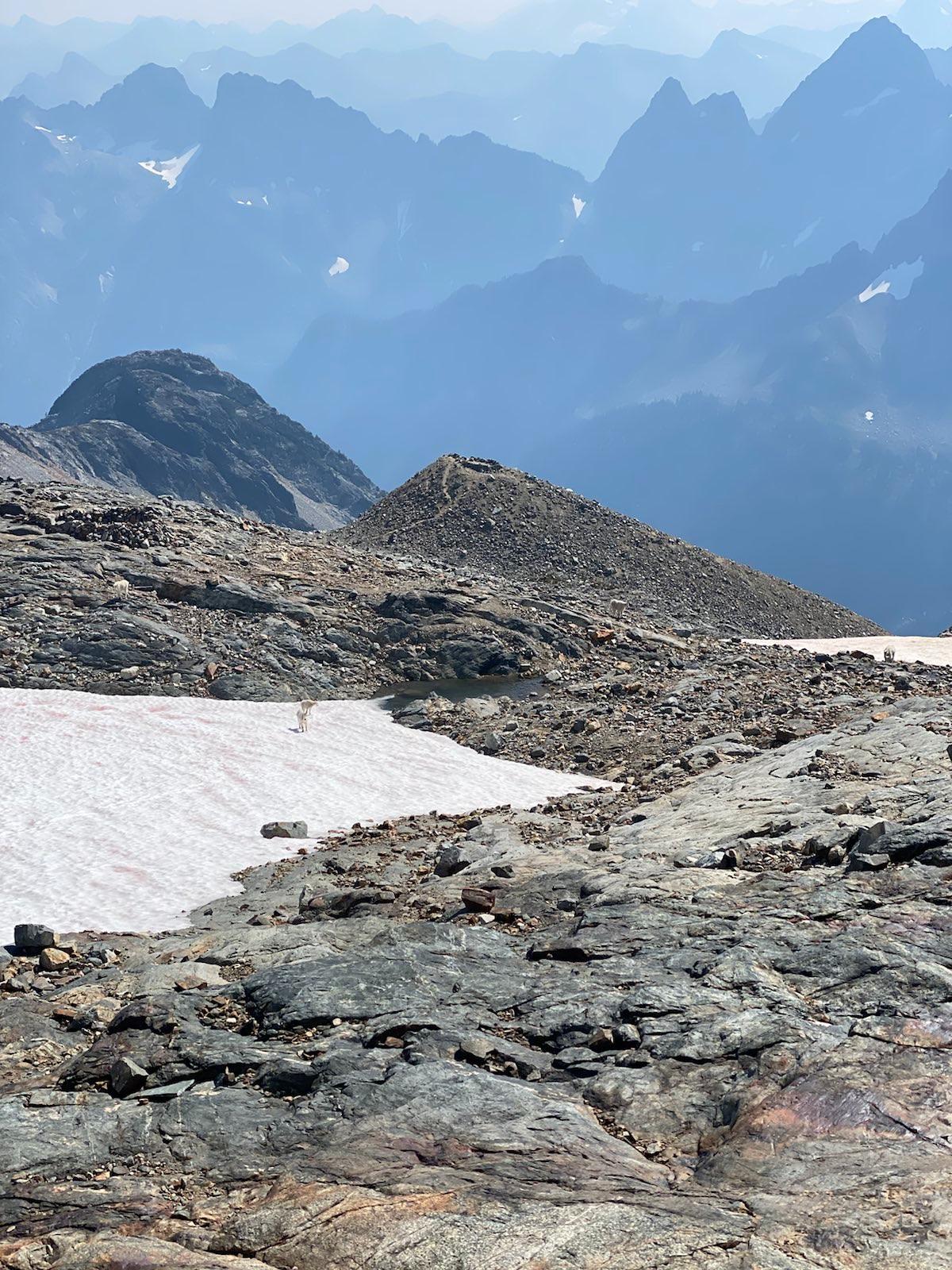
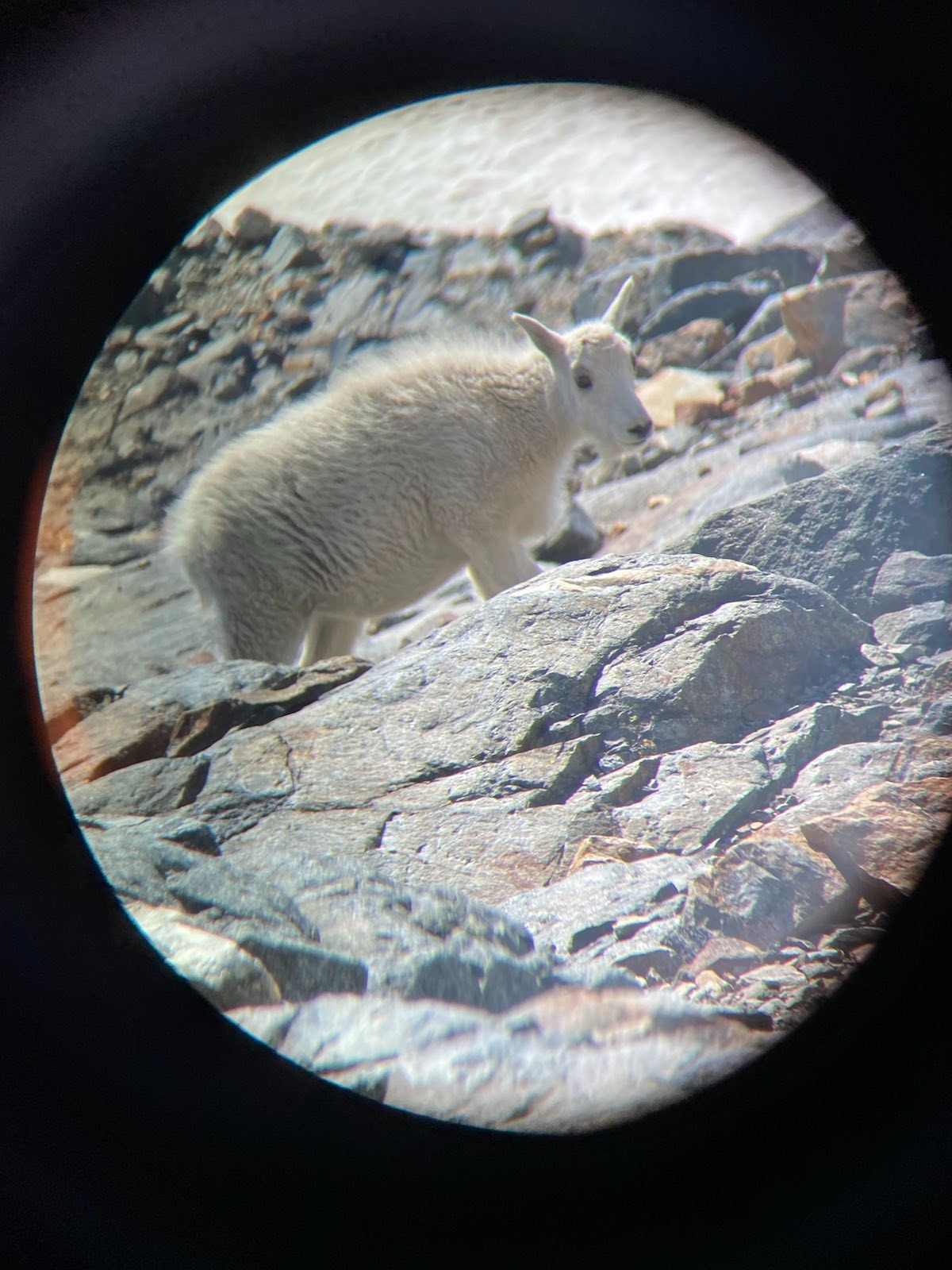
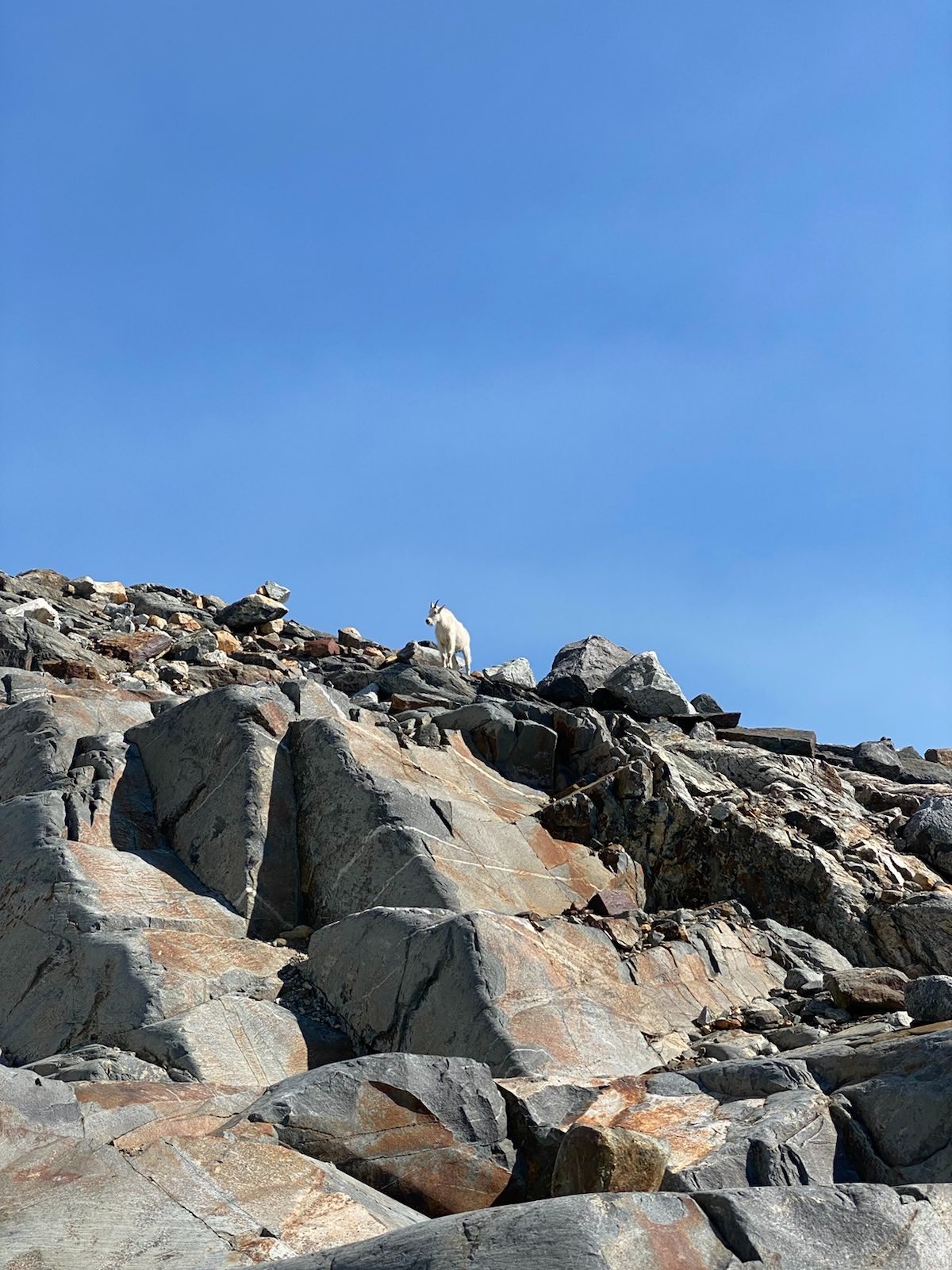
It quickly dawned on me that the plateau itself was actually quite large; deceptively wide. It would take me a while to get across. Also, along my journey, there were many mountain goats. (A lot of the day hikers near the main viewpoint kept getting too close. I did not want to be a part of this stupidity so I moved away from them.) The goats were fearless, curious, and stared at us with eyes of unblinking unfathomable understanding. I counted 7 adults, and 3 babies.
Along the way to the other edge of the plateau, I took too many photos.
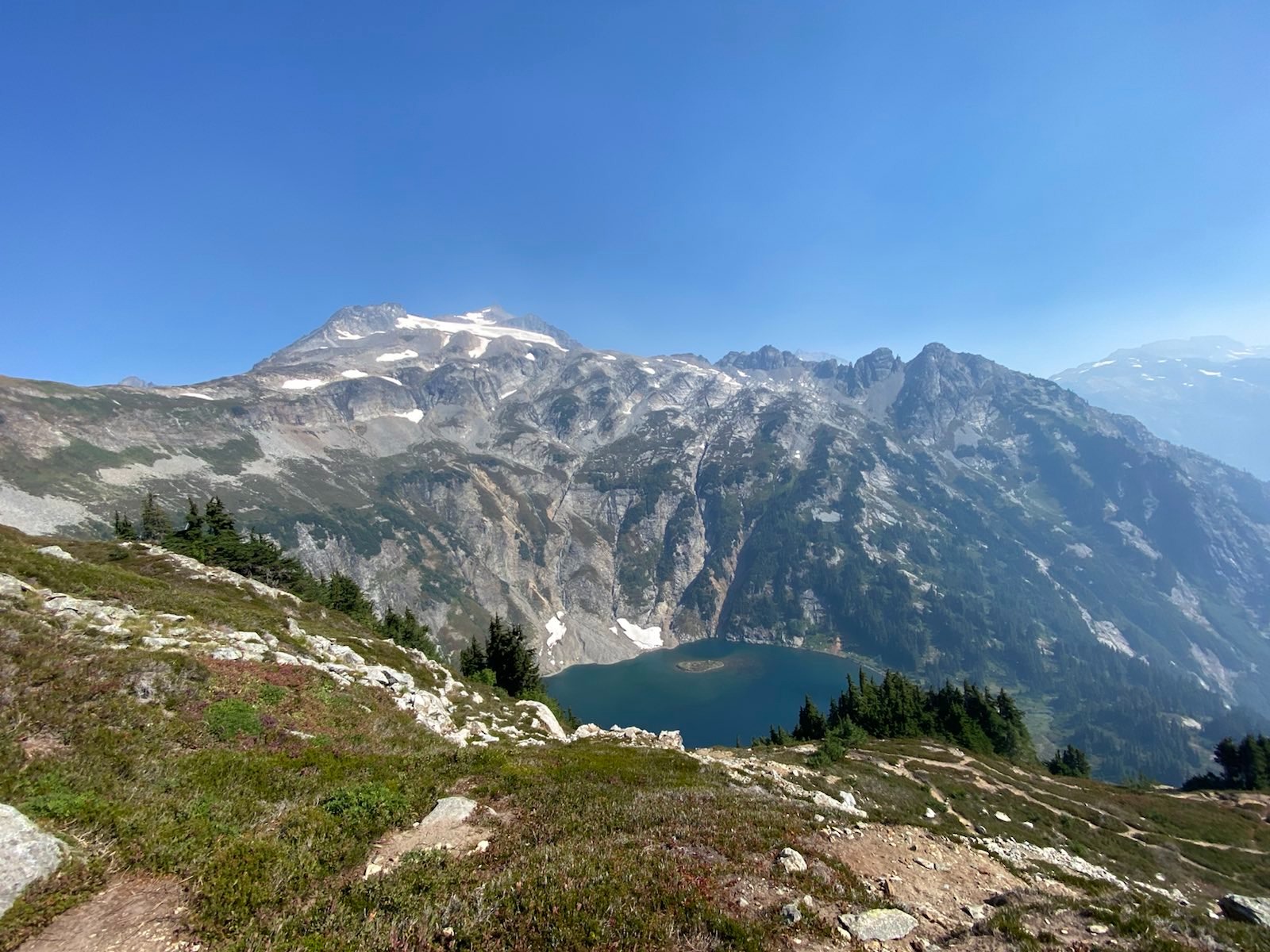
The shining Doubtful Lake, which no one actually ever goes down to, due to the steepness, and also because the Plateau is so much more popular and spectacular:
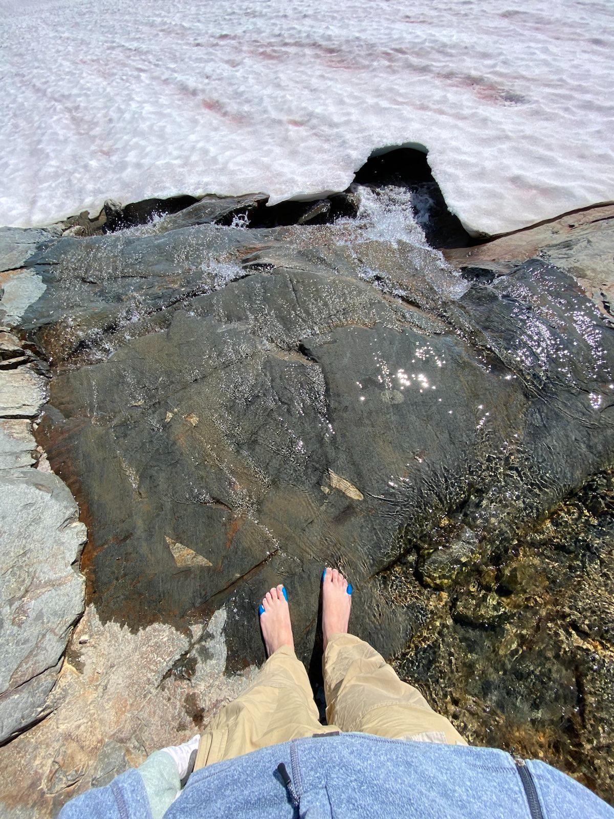
Along the way, I found a quiet, mini valley in the plateau, where there was a small glacier lake and very shallow water flowing over a smooth rock. As always, the cancer found his flowing water. I took off my boots and proceeded to wash my feet. I kept checking around me to see if the goats were coming near. Luckily, none came to bother me. The water was ice cold, but the air was fine, and the smoke was gone, and my feet felt clean. I watched the water rush under the mini glacier below, and wondered if I slipped and fell into it like one of those water parks tunnels, if I would ever get out again. The imagination of that shallow death was an odd thought on this plateau that was so bright and beautiful.
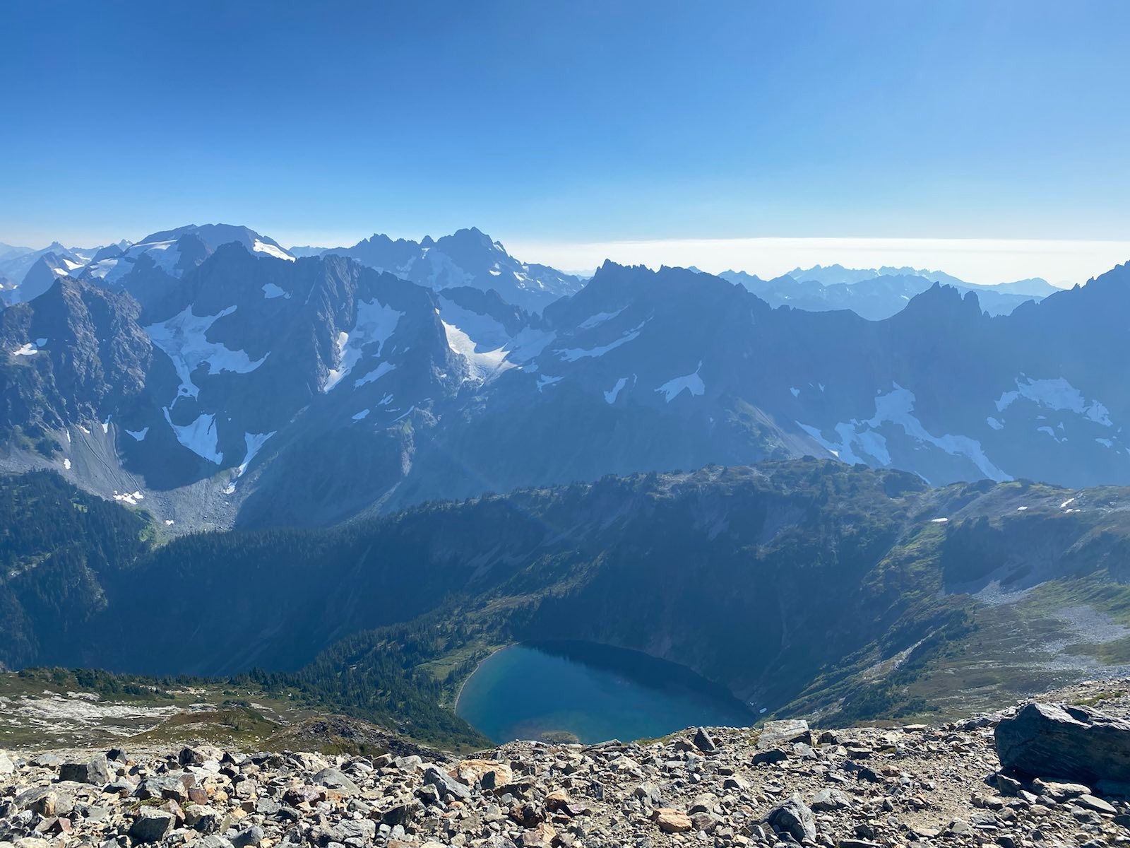
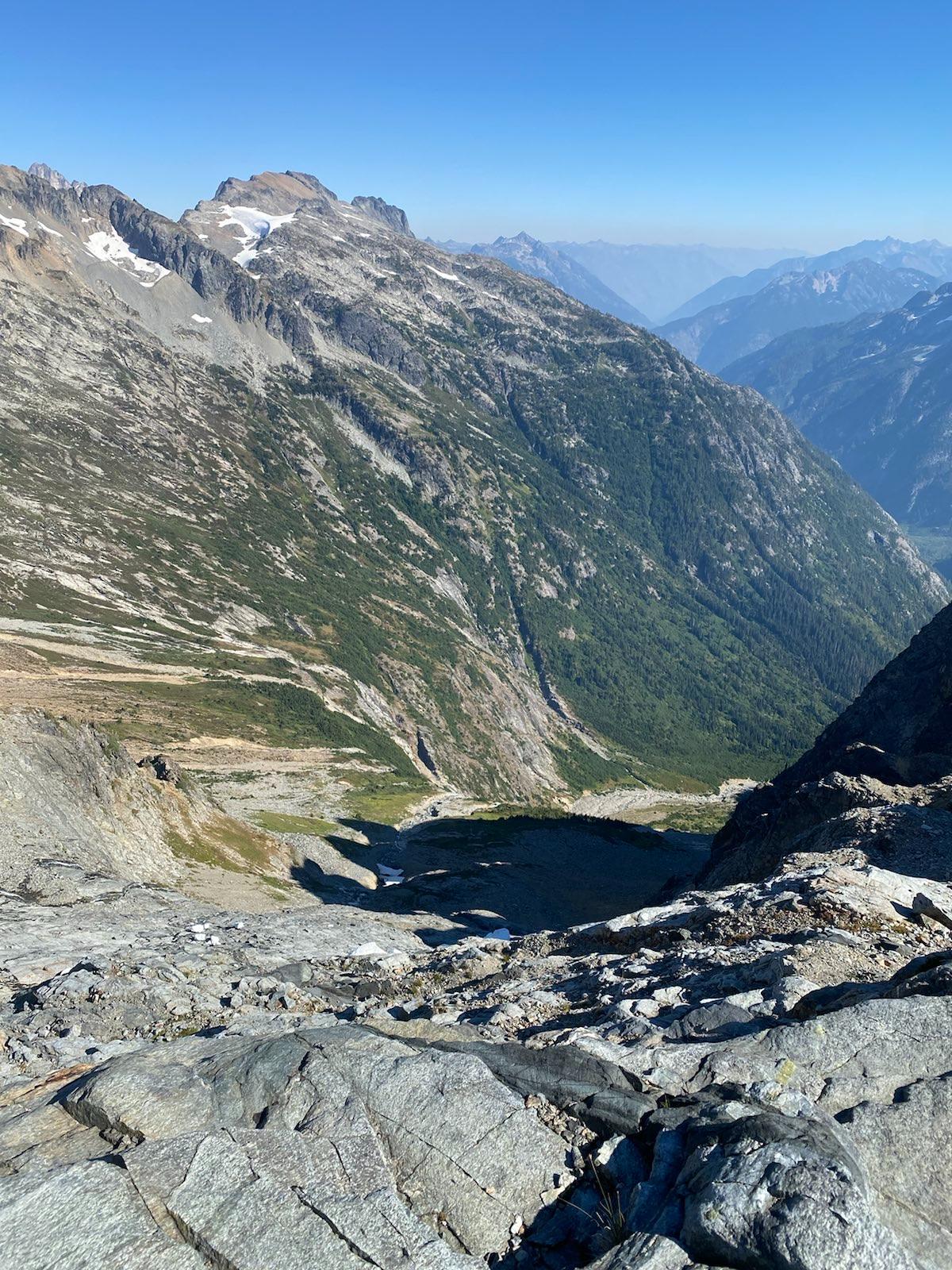
Done with the wash, I continued to the end, and found myself looking down at Horseshoe Basin. This was a basin that most backpackers don’t even visit. The view from above was probably also not often seen, as there were few indications that campers and day hikers ever came this far. However, the drastic change from rock to green was marked, and the circular basin sounded with shallow rushing streams, cresting over smooth rock, like where I washed my feet, but on a much larger scale.
Usually, my hikes involve one or two viewpoints. But this hike was a viewpoint from start to finish! I was so happy that the smoke mostly cleared, and I could see so much, but so many views also put a strain on my mind and heart, as I didn’t know where I should stop. In reality, I think I should have just sat at the stream for longer, but my mind wanted to see the end of the plateau. From the edge at Horseshoe Basin, it took me another 45 minutes to get back to the main entrance of the plateau, where all the other day hikers congregated. At this point I was very tired. The routefinding along the rock was hard, and some places were very lose and steep. I had to cross two mini glaciers without ice equipment, but luckily nothing happened.
Reaching the main area, I noticed many many more campers were setting up. 6 different groups, about 14 people. Some had their tents on Sky Castles, others were hiding behind so as to stay out of the wind. I started making my way down. It was 5pm. I had stayed up on the Plateau from 2pm to 5pm.
On the way down, I met 5 hikers who were still trying to come up. One of them, who seemed more sensible than the rest, asked me, how much further? I said, another half hour. He said, man, I wish I had brought a transponder like you did, I dont think this is safe. I looked at him and said, you look strong, you can do it. Just don’t stay for more than 15 minutes. Make sure you start coming down before twilight. And he looked at me and said, you think so? Alright, I’m gonna do it.
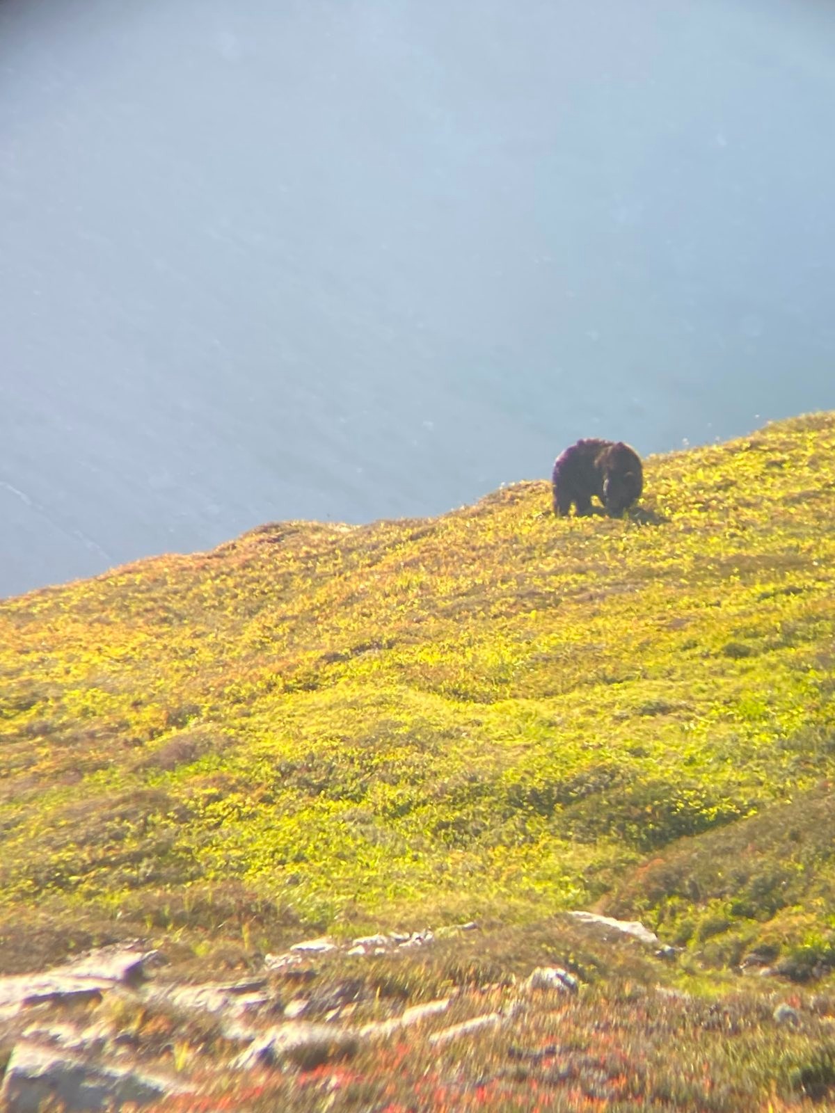
As he went up, I kept going down, and I saw this furry object, moving in the distance. It was too big to be that furry. Oh no no no. It was a huge black bear, munching on the grass and shrubs. I took a photo through my binos and then yeeted out.
As I was slowly enjoying my walk down the arm meadow, I stopped at a viewpoint. As I enjoyed the beautiful colors and the clearer skies, suddenly, that same guy came down. He said, I made it! I was like, that was really fast! He said yea, you were right, I could make it, but the scree was really bad, and the moment I got up there I felt like I had to go, since the sun was starting to set, and I just didn’t feel safe with the wind and the coming darkness and the steep trail. I said, well, you can join me and we can hike down together. He said yea, plus, I don’t know if you know, but there’s another bear in addition to one over there. I said, where?! He said, when I was coming up the early switchbacks, a bear zoomed past. So let’s hike together. I agreed.
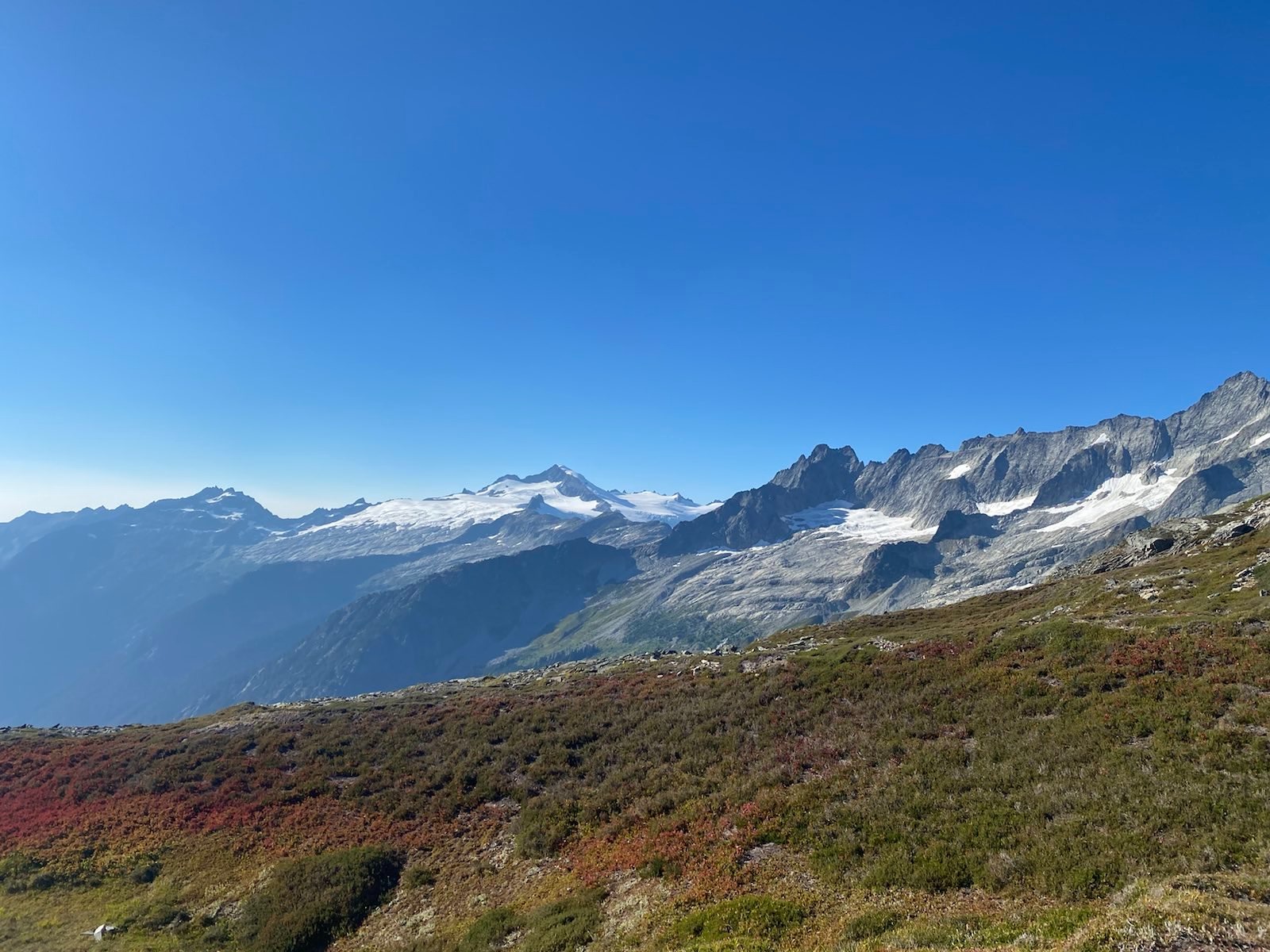
Beautiful ridgelines of Mt Boston, Mt Torment, and El Dorado, from the arm viewpoint:
So we walked and talked, and it was good fun. David was a guy from New York, his entire family there, some of them very Orthodox Jewish. He said his ancestors were from the Negev, and when I knew where that was (the big pointy desert part in the South), he was surprised, since many people don’t know this. (I like to think that my humanities, history, and philosophy education has prepared me to basically know random facts to make friends with. LOL.) We kept walking, looking at the now completely shaded Doubtful Lake. We made our way down the second hill, and finally arrived at the Cascade Pass monument. The smoke here was now much clearer than from the morning, and David took a photo for me.
The beautiful Cascade Pass, where glaciers a mile thick ground their way across the mountains, where waters flow from the jagged spires, where Native Americans trod for thousands of years, before the white man came, before the trails were built, before Tom Cruise and Top Gun polluted the skies with F-16s, before my weak and pampered self came to take a look:
We sat and watched the light shift, shift and shift. We looked at the Ptarmigan Traverse high route, and marveled at the fact that people were even capable and insane enough to do such a ridiculously dangerous trail. We ate some snacks, drank some water, and talked some more. Turns out, David had left the East Coast to get away, to start living his own life, a mix of tech work, outdoors, and trying to find a girlfriend after his ex moved to Austria and didn’t want to come back. A most genuine, funny, and interesting guy.
Golden Hour in the smoke:
Finally, we decided to leave, as it was actually getting quite dark and cold, and David was running out of water. (It turns out, he had just gotten into hiking this year. He wsa still figuring out what equipment he needed, what he liked and didnt’ like. And he was quite strong! I often had to tell him to slow down and enjoy the view, as he kept passing great viewpoints, and also, he was moving so fast that he constantly was tripping over himself. But his lively spirit and buzzing happiness never dampened!) I also forgot to bring my filter. As we made our way down the gentle switchbacks, we sang Beatles and Queen (David was once in a rock band), our voices ringing into the dark forest, scaring away the bears. Eventually it got so dark we had to start using headlamps, and the last 90 minutes of the hike was done with beams on. Finally, we reached the parking lot. One truck with a 4wheel pop up camper was camping in the lot, even though it was technically illegal. Sigh.
I made some hot MountainHouse food for us, and we enjoyed a carb rich meal under the oddly bright night sky. We traded equipment reccomendations, and I provided him tips on logistics and hike planning (noob though, that I am). The biggest things I learned from hiim were to try out toe socks, and use electrolyte powders/pills. Now that I am doing those things, those were on point recs.
Finally, we hugged our goodbyes, getting Signal # for the next potential meet, and each set out back for Seattle. I then realized why it was so bright: the moon was full and reflected the lost hours of the day through my car window: the stars shining totally clear. I knew the smoke wasn’t going to stay away for long, and so my next trip would have to be away from the Cascades. That threw a wrench in my planning from a month ago, but as the Summer was quickly closing, I wasn’t going to let that stop me now!